Oil Basins Limited (ASX:OBL) Updates on Backreef Area Prospective Resources
Melbourne, Nov 23, 2011 AEST (ABN Newswire) - Oil Basins Limited ( ASX:OBL) are pleased to make the following ASX announcement as a matter of record so as to keep the market fully informed about a significant independent re-assessment of the prospectivity of its Backreef Area interests in the Fitzroy Trough region of the Canning Basin, Western Australia - OBL net 100% beneficial interest.
Following the collection of previously recorded 2D seismic data of various vintages, Dayboro Geophysical Pty Ltd reprocessed original field data deriving PSTM and PSDM seismic outputs.
The Company using this PSDM data completed its interpretation of the potential New Oil Play within the Backreef Area using advanced Schlumberger PetrelTM seismic interpretation software (refer to OBL ASX Release 30 August 2011).
In September the Company engaged RPS Energy Services Pty Ltd ("RPS") to prepare an Independent Resource Evaluation Report to assess the following:
- Petrophysical analysis of electric logs from Backreef-1,
- Independent interpretation of prospect mapping using PetrelTM software
- Definition of possible new leads within the possible Backreef Area
- Recommendations for future work
This Resource evaluation covers the hydrocarbon Resources in the Canning Basin permits L6, EP129 R2 and EP129 R3 in which the OBL Group has a 100% interest via wholly owned subsidiaries. RPS made Low, Best and High estimates of Prospective Resources as of 1st October, 2011.
The Resource estimates in the Report and Summary (see link at the bottom of the release) are in accordance with standard petroleum engineering techniques and using the March 2007 SPE/WPC/AAPG/SPEE Petroleum Resources Management System (PRMS).
KEY POINTS
- RPS Energy Pty Ltd (RPS) has completed an independent comprehensive technical review of the Backreef-1 well result and the recent OBL interpretation of the previously assessed New Oil Play within the Backreef Area
- Using its own assessment of Backreef petrophysics and its own mapping of New Oil Play, RPS has concluded in accordance with strict PRMS guidelines that the Backreef Area could host a significant aggregated undiscovered potential Oil in Place (OIP) volume of between 45.6 to 117 MMbbls with an expectation of 77.7 MMbbls and a mean estimate of 20.6 MMbbls Prospective Resources.
- Eight (8) Leads have been independently derived by RPS within the southern and south-eastern portions of the Company's Backreef Area.
- Four (4) Leads have potential to be larger than the Blina Oil Field which has an initial OIP of circa 5.7 MMbbls (with circa 1.9 MMbbls produced since 1981) and is the largest field so far discovered within this region of the Fitzroy Trough).
- Two newly mapped stratigraphic Leads, notably Lead E and Lead F, are potentially large with indicative areas greater than 4 km2. RPS has delineating a gross recoverable Prospective Resource greater than 5 MMbbls for these two Leads.
RPS Assessment of New Oil Play
The RPS assessment in accordance with PRMS is summarised in the attached Letter to Oil Basins Limited dated 22 November 2011 and investors are reminded to refer to the key assumptions and Glossary of definitions in this Letter.
RPS undertook a horizon and fault interpretation of the 2D seismic data using Schlumberger PetrelTM seismic interpretation software. The previously recorded seismic data of various vintages were reprocessed from original field data in 2011 by Dayboro Geophysical Pty Ltd.
PSDM data (derived from PSTM) was used for interpretation. RPS considered the seismic data quality to be generally sufficient to delineate the two primary reservoir intervals (Yellow Drum Formation and Nullara Limestone). However the sparse 2D seismic coverage was not sufficient to detail faults and structural closures with certainty so only Leads were defined.
RPS Delineated Leads within the Backreef Area
In brief the conclusions of RPS independent assessment can be summarised in Figure 2 and Tables 1 and 2 (see link at the bottom of the release)- specific features of the Leads defined by RPS are detailed as follows:
- Lead A (East Blina Lead) is a Top Yellow Drum Formation structural rollover observed on one seismic line, BV93-17 and is located approximately 3 km east and updip of the Blina field, and 4 km west of Backreef-1. Mapped P50 area and volumes - area 0.359 km2, GRV 19.7 km2.m and Undiscovered OIP 1.86 MMstb
- Lead Backreef is a Top Yellow Drum Formation structural rollover observed on one seismic line, BV93-17 and is located approximately 6 km east and updip of the Blina field, and includes the Backreef-1 well notionally on the edge of possible mapped closure. Mapped P50 area and volumes - area 0.226 km2, GRV 12.4 km2.m and Undiscovered OIP 1.17 MMstb.
- Lead B is a Top Yellow Drum Formation structural rollover observed on one seismic line, BV93-16 and is located approximately 5 km east and updip of the Blina field, and 2 km southeast of Backreef-1. Mapped P50 area and volumes - area 0.421 km2, GRV 23.1 km2.m and Undiscovered OIP 2.18 MMstb
- Lead C is a Top Yellow Drum Formation structural rollover observed on one seismic line, H80-56 and is located approximately 4 km northeast and updip of the Blina field, and 5 km northwest of Backreef-1. Mapped P50 area and volumes - area 0.288 km2, GRV 15.8 km2.m and Undiscovered OIP 1.49 MMstb
- Lead D is a Top Yellow Drum Formation structural rollover observed on one seismic line, H84-0573, and is located approximately 6.5 km north of Mariana-1. Mapped P50 area and volumes - area 1.23 km2, GRV 67.4 km2.m and Undiscovered OIP 6.37 MMstb
- Lead E is a Top Yellow Drum Formation stratigraphic trap closed against a channel incision, and observed on three seismic lines. It is located approximately 8 km northeast of Mariana-1 and 7 km northwest of Harold-1 and relies on lateral seal being provided by shale-filled channels. Mapped P50 area and volumes - area 4.12 km2, GRV 226 km2.m and Undiscovered OIP 21.3 MMstb
- Lead F is a Top Yellow Drum Formation stratigraphic trap closed against a channel incision, and observed on three seismic lines. It is located approximately 1.5 km east of Backreef-1. Mapped P50 area and volumes - area 5.96 km2, GRV 327 km2.m and Undiscovered OIP 30.9 MMstb
- Lead G is a Top Nullara Limestone structural rollover observed on one seismic line, H84-073, and is located approximately 10 km northeast of Blina, 2.5 km north of Backreef-1, and 3 km south of Harold-1. Lead G partly underlies the Yellow Drum Formation Lead F. Nullara Limestone was not reported to be present in Backreef-1, but was reported in Harold-1 and Mariana-1 with shows. Mapped P50 area and volumes - area 1.27 km2, GRV 73.7 km2.m and Undiscovered OIP 8.93 MMstb
RPS has also determined the probability distribution for the overall Prospective Resources total in Figure 3 (see link at the bottom of the release).
Oil Basins Comments
The Backreef Area is undoubtedly a good and highly prospective hydrocarbon address.
The Company is delighted that this independent peer review has defined an inventory of Leads within the hitherto under-explored Backreef Area which are potentially both prospective and importantly situated at relatively shallow depth (less than 1,000mTVDss) and therefore relatively cheap to both drill and complete.
Investors should note that the RPS petrophysically identified net pay of circa 12m in Backreef-1, is considerably smaller than the net pay of circa 40m from earlier Weatherford petrophysics analysis. RPS's seismically mapped closure is smaller than OBL's log-interpreted closure, and in addition due to strict PRMS guidelines specifically ignores any potential stratigraphic trap potential in the immediate vicinity of Backreef-1 (captured updip via Lead F).
In OBL's opinion, the proposed cased hole production test at Backreef-1 will provide sufficient downhole information to resolve the assumption differences between Weatherford and RPS and if the test is successful, a suitably designed and located appraisal well (ie Backreef-2) in the first instance followed by modern 2D seismic will definitely determine the stratigraphic and/or structural nature of the Backreef Lead and better define the definition and closures of all Leads It's very likely that if not from the same deepened well bore, Leads F and G can be drilled from the same drilling pad. The Company believes this new work constitutes a major independent geophysical and geological assessment and 'expert peer review' of the prospective resources potentially within the Kimberley Downs Embayment feature contained within of the Backreef Area.
The Company is greatly encouraged by the RPS peer review and intends to immediately followup on a number of their recommendations in the 2012 work program, to further reduce uncertainties in the asset; namely
- Test Backreef-1 to confirm the fluid content, permeability and hydrocarbon productivity of the reservoir.
- If the test is successful, drill a better positioned step-out Backreef-2 appraisal well to recover cores of the reservoir and define the OWC and/or deviate into thicker reservoir section, and
- Should the Backreef-1 cased hole production test be successful, consider shooting modern 2D seismic to determine the stratigraphic and/or structural nature of the Backreef Lead and better define the definition and closures of all Leads If future exploration is successful in this New Oil Play Area within the Backreef Area is likely to be a 'Company Maker' for OBL, given its high beneficial ownership (OBL net 100%).
Additional Prospective Resource Potential
The deeper unconventional shale gas (USG) potential of the Kimberley Downs Embayment was not re-assessed in this new RPS study of which was limited to assessing the prospective resources potential of the New Oil Play only.
The unrisked potential gross 'gas in place' USG resources was previously independently assessed at between 4.3 Tcf to 21.3 Tcf GIP (refer to OBL ASX Release 8 July 2010).
For the complete Oil Basins Limited announcement including figures and tables, please view the following link:
http://media.abnnewswire.net/media/en/docs/ASX-OBL-365411.pdf
Contact
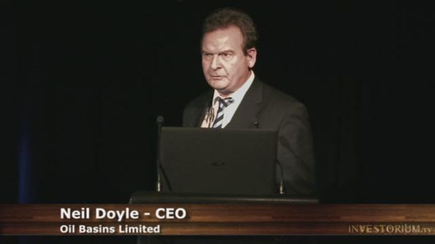
Neil F. Doyle SPE
Director & CEO
Oil Basins Limited
Tel: +61-414-912-901
Email: n.doyle@oilbasins.com.au
| ||
|


