20% increase in Mineral Resources at Kogi's Agbaja Project to 586Mt
Sydney, Dec 10, 2013 AEST (ABN Newswire) - Australian based iron ore development company, Kogi Iron Limited ( ASX:KFE) ("Kogi", or the "Company") and it's 100% owned Nigerian operating company, KCM Mining Limited ("KCM") is pleased to advise of a substantial increase in the estimated Mineral Resources for its 100% owned Agbaja Iron Ore Project located in Kogi State, Republic of Nigeria, West Africa ("Agbaja" or "Agbaja Project"). The estimate includes for the first time, an Indicated Mineral Resource.
Highlights
- Mineral Resources for the Agbaja Project increase 20% to 586 Mt at 41.3% Fe
- Includes an Indicated Mineral Resource of 466 Mt at 41.4% Fe
- Demonstrates potential for significant project scale and life
- Only 20% of the prospective area within EL12124 has been drilled
Mineral Resources increase to 586 million tonnes
The global Mineral Resource for the Agbaja Project has increased 20% from the previous estimate of 488 million tonnes to 586 million tonnes with an in-situ iron grade of 41.3% ("Updated Mineral Resource").
Importantly, the Updated Mineral Resource includes Indicated Mineral Resources of 466 million tonnes at 41.4% Fe, with the balance of the Mineral Resources classified as Inferred (120 million tonnes at 41.1% Fe)(refer Table 1).
Table 1 - Summary Grade Tonnage for Laterite (Zone A) and Oolitic (Zone B) Horizons (20% Fe lower cutoff is applied)
--------------------------------------------------Classification Tonnes (Mt) Fe (%)--------------------------------------------------Zone A (Laterite Mineralisation)Indicated 147.5 33.2Inferred 33.9 31.7Total Indicated + Inferred (Zone A) 181.4 32.9--------------------------------------------------Zone B (Oolitic Mineralisation)Indicated 318.7 45.2Inferred 86.3 44.7Total Indicated + Inferred (Zone B) 405.0 45.1--------------------------------------------------Combined Zone A and Zone BTotal Indicated 466.2 41.4Total Inferred 120.1 41.1Total Indicated + Inferred 586.3 41.3--------------------------------------------------
The Updated Mineral Resource is reported in accordance with the JORC Code (2012) and was compiled by Mr David Slater from independent, international consultancy, Coffey Mining Pty Ltd ("Coffey") and Dr Warwick Crowe from International Geoscience Pty Ltd.
Commenting on the Updated Mineral Resource, Kogi's Managing Director Mr Iggy Tan, said: "The Updated Mineral Resource is an important milestone in Kogi's vision to be an African iron ore producer. Of significance is the classification of 466 million tonnes of resources as Indicated. Not only does this demonstrate an increased level of geological confidence in the Agbaja deposit, but it provides a solid platform upon which the Company can continue to advance the current Scoping Study that is assessing the technical and economic viability of potentially producing 5 Mtpa of iron ore concentrate at Agbaja. A 466 million tonne Indicated Mineral Resource has the potential to provide sufficient material for more than 35 years of production at this annual rate."
"Considering Kogi Iron has drilled only 20% of the area prospective for channel iron mineralisation within EL12124 on the Agbaja Plateau, the potential scale of the iron mineralisation on the plateau should not be underestimated. The Indicated Mineral Resource, as it currently stands, clearly has potential to support an operation producing in excess of the 5 Mtpa scenario being contemplated in the Scoping Study. The average iron grade of 41.4% ranks Agbaja as one of the highest grade, beneficiable iron ore deposits in West Africa which we believe sets it apart from other projects."
Drill hole locations and typical cross section of the deposit
A collar plan of the data used in the Updated Mineral Resource, and a typical cross section is provided in Figure 1 and Figure 2 respectively in link below.
Technical Discussion
The Agbaja Project lies 15 km northwest of the city of Lokoja in Kogi State, Nigeria. Lokoja is approximately 165 km south west from Abuja, which is the capital of Nigeria, and 400km north east of Lagos. Kogi through its wholly owned Nigerian subsidiary KCM Mining Limited obtained the prospecting right for EL12124 in January 2012 for a period of three years. The Company has a 100% beneficial interest in the tenement.
The Agbaja Plateau is a deeply dissected table-land with an area of approximately 64 km2 stretching southwards along the west bank of the Niger river from opposite Koton Karfi to within 7 km of Lokoja. The oolite/pisolite ironstone is part of a Campanian to Maastrictian (Upper Cretaceous) continental fluvio deltaic to shallow marine sequence of the Agbaja Formation and includes interceded sandstone and mudstone. The Agbaja Formation succeeds the brackish to marginal shallow marine argillaceous sequence with sandstone, siltstone, and carbonaceous mudstone with organic debris of the Patti Formation.
Iron mineralisation within the Agbaja Plateau is a Channel Iron type deposit hosted in the sub-horizontal to very shallow east dipping, Late Cretaceous Agbaja Formation and typically forms the resistant hard cap top of the plateau. The margins of the plateau are characteristically bound by prominent escarpments of a few metres to tens of meters above a flanking scree slope comprising eroded Agbaja Formation and the softer underlying Patti and Lokoja Formations.
The Agbaja Formation and the iron mineralisation is laterally and aerially extensive across the Agbaja Plateau and consists of an upper unit comprising beds of ferruginous sandstone and reworked oolite/pisolite material (referred to as the Laterite unit) that overlies a sequence of massive ferruginous oolite and pisolite in a ferruginous matrix.
Both the Lateritic and Oolitic units show an overprinting secondary ferruginisation, often seen as resistant vertical and horizontal bands which have exploited bedding and fracture surfaces, and as concentric zonations within the units and typically between ferruginous fractures. Subsequent weathering with associated lateritisation has overprinted the overlying sandstone unit and the upper edge of the main oolitic unit. The principal iron minerals in both the matrix and ooids/pisolites of the main oolititc unit are goethite and maghemite/magnetite, and in the upper lateritic sandstone (including thin oolitic layers) the principal iron mineral is goethite with subordinate hematite.
The mineralogical work to date indicates that the main iron oxides and hydroxides are goethite and maghemite/magnetite. These phases are finely intergrown with one another. The iron present is approximately 95% made up these iron oxides and hydroxides.
Drilling Programme
The Agbaja deposit was sampled using a reverse circulation ("RC") and diamond drill holes ("DD") on nominal 200m x 100m grid spacing. A total of 686 RC drill holes were drilled for 16,244m. The DD was primarily used to 'twin' the RC drill holes. A total of 11 twin DD drill holes were drilled for 233m.
RC drilling samples were taken at consecutive 1m intervals down hole and riffle split to 1-2kg, then dispatched for sample preparation at ALS Minerals, Ghana. Twin drilling by PQ diamond coring was undertaken for the DD drill holes.
DD drill hole core was shipped to ALS/AMMTEC laboratories in Perth and 1m interval samples were taken (complete core sections) for analyses. All RC and DD drilling were logged with recovery recorded and entered into a sampling database with standardised codes on-site as soon as practically possible after the drill holes were completed.
The prepared RC samples were then freighted to ALS Perth in Australia. Assay of RC samples by industry standard techniques was performed by ALS Geochemistry, Perth, Western Australia comprising:
- 24 elements/oxides by XRF fusion (ALS code ME-XRF21n)
- LOI1000 by TGA furnace (ALS code ME-GRAO5)
Techniques are considered as total concentration.
For the RC drilling, a quality control programme was implemented by Kogi to ensure the accuracy and precision of the data collected. The results obtained show that the accuracy and precision of the data is sufficient to be used in mineral resource estimation.
Drill hole collars were surveyed using DGPS by registered surveyor (MinStaff Survey Pty Ltd) and tied into a global grid. The grid system used is UTM WGS85_32N. The surface topography used in the mineral resource is derived from a combination of the 30m Shuttle Radar Topography Mission (SRTM) and drill hole collars. The topography is adequate for use in the resource estimate and has been considered in resource classification at the resource margins where the lower accuracy SRTM data was used.
Classification
From the geological, metallurgical and assay information, it was determined that the iron mineralisation could be divided up into two domains. The first domain, Zone A, is described as laterite in geological logging with 20% < Fe < 40%, low phosphorous values and elevated titanium dioxide values. The second domain, Zone B, is described as oolite/pisolite in geological logging with Fe > 30%. The geological/mineralisation interpretation was developed for Zone A (Laterite) and Zone B (Oolite) and used as hard boundaries (wireframes). Where kaolinised sandstone lenses lay within and between Zone A and Zone B, the lenses were wire framed separately as internal waste.
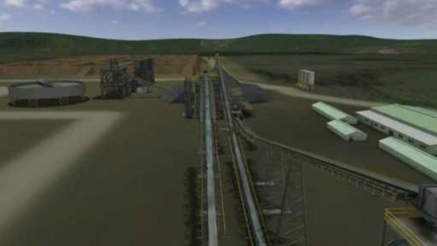
Metallurgically, it is currently considered that mined material will be crushed to around <10mm by a two stage crushing system. The crushed material will be further milled and then fed to a beneficiation plant incorporating a simple magnetic separation process to produce a final upgraded iron ore concentrate.
Resource Estimation
The Mineral Resource was estimated using Ordinary Kriging (OK) techniques. Variographic analyses were completed on Zone A and Zone B. Search parameters were based on variography carried out on the 1m composites and supported by geological knowledge gained from field mapping and drill hole data. In addition to Fe, a full suite of elements were also estimated including SiO2, Al2O3, P, LOI, CaO, K2O, MgO, Mn, Na2O, S, TiO2 , P, SiO2 and Al2O3.
The parent block size has considered drill hole spacing and variography results, as have the search parameters. Selective mining units were not defined or corrected for in the resource estimate; however, a bulk open pit mining scenario was considered in selection of the parent block size. A Scoping Study is currently in progress.
The Mineral Resource estimate was validated through comparison of input and estimated grades visually and statistically. The estimate was also validated by looking at number of holes and samples used, average distance to informing samples, slope of regression and other statistical checks.
The current Mineral Resource was compared with the previous Coffey 2012 Mineral Resource. The differences are noted as resulting from both extensional and infill drilling, and an improved understanding of the geology and mineralisation after further field work was completed in 2013.
Grades and tonnage were calculated for each domain. An in situ dry bulk density was calculated using a combination of a 'tray weight' measurement for Zone A and 'weight in water' measurement for Zone B to estimate the tonnage for each domain. An in situ dry bulk density of 2.02t/m3 and 2.28t/m3 was calculated for Zone A and Zone B respectively.
The Mineral Resource classification was developed from the confidence levels of key criteria including topography, drilling methods, geological understanding and interpretation, sampling, data density and location, appropriateness of the grade estimation method and parameters, and quality of the resultant block estimates.
The Mineral Resource declared for the Agbaja Plateau Iron Ore Project is categorised as a combination of Indicated and Inferred material as described in Table 1 above and Table 2 below with full elemental analysis. The Mineral Resource should be viewed in conjunction with 'JORC Code 2012 Table 1' below, that forms part of this announcement.
Summary of Resource Estimate and Reporting Criteria
As per the 2012 JORC reporting guidelines, a summary of the material information used to estimate the Mineral Resource is detailed below (for more detail please refer to the tables in Appendix A):
Geology and Geological Interpretation
The confidence in the geological interpretation is good. Iron mineralisation within the Agbaja Plateau is a Channel Iron type flat lying deposit that is continuous and homogeneous. The deposit is aerially extensive across the Agbaja Plateau. The drilling, analysis and subsequent resource modeling has been conducted from very close spaced 200m x 100m RC and DD core samples with all drill hole collars surveyed using DGPS by registered surveyor (MinStaff Survey Pty Ltd) and tied into a global grid within Kogi Irons 100% owned tenement EL12124.
Sampling and sub-sampling techniques
A total of 686 RC drill holes were drilled for 16,244m together with a total of 11 DD drill holes were drilled for 233m. Samples were taken (1-2kg RC sample splits and whole core sections) and analysed at consecutive 1m intervals for the RC and diamond core drilling. Industry standard sample preparation and analyses was undertaken by ALS laboratories in Ghana (RC sample preparation) and in Perth (RC sample analyses and core preparation and analyses).
Drilling techniques
All drilling used in the resource estimate was vertical and perpendicular to flat-lying to sub-horizontal sedimentary beds and channels that host the iron mineralisation. RC drilling (6 inch hole diameter) using a face-sampling drill bit and account for 99% of the drilling database. RC drill hole depths range from 12.5m to 35.5m with 3 deeper RC holes drilled to a maximum of 84m for sterilisation purposes. Vertical diamond drilling was conducted using double tube PQ sized conventional 1.6m drill tube on a converted RC drilling rig. DD drill hole depths range from 16.9m to 29.8m.
Classification criteria
Mineral Resource classification was developed from the confidence levels of key criteria including topography, drilling methods, geological understanding and interpretation, sampling, data density and location, grade estimation and quality of the estimates.
Agbaja Project has been classified as Indicated according to JORC 2012.
Sample analysis method
Assay of the RC and DD samples were conducted by XRF fusion to analyse 24 elements/oxides which is the current industry standard for iron ore. Kogi QAQC iron ore standards were inserted in the RC drill hole sample sequences randomly at a ratio of approximately 1 in 8 prime samples; blanks and field duplicates are inserted at a ratio of approximately 1 in 16 prime samples and show acceptable levels of accuracy and precision with respect to known values in the case of standards and blanks, and the correlated duplicate and prime samples.
Estimation Methodology
The Mineral Resource was estimated using Ordinary Kriging techniques in Vulcan mining software. Search parameters were based on variography carried out on the 1m composites and supported by geological knowledge gained from field mapping and drillhole data.
Cut-off grades and Bulk Densities
The 20% Fe lower cut-off is grade is used for reporting of the Mineral Resource estimate which is based on generally accepted industry practice. In situ dry bulk densities were assigned on the basis of measurements collected from the 2013 drill core using a combination of 'weight in water' technique and tray weight/volumes.
Mining and metallurgical methods and parameters
It is currently considered that mined material will be crushed to around <10mm by a two stage crushing system. The crushed material will be further milled, fed to a beneficiation plant and through a simple magnetic separation process, with a final upgraded iron ore concentrate to be produced. Previous announced metallurgical testwork have demonstrated the recovery using the proposed flow sheet, optimising mass and iron recovery, and concentrate grade for the mineralisation. Two mining areas (Stage 1 and Stage 2) have been identified, pits designed, and material movement schedules have been completed for the first 20 year mine life (See ASX release 28 November 2013).
To view complete release, please visit:
http://media.abnnewswire.net/media/en/docs/ASX-KFE-661340.pdf
About Macro Metals Limited
Macro Metals Limited is an ASX-listed company (ASX:M4M) with the intent to build a cast steel plant on the Agbaja Plateau in Kogi State, Nigeria. The project will utilise company leased iron ore deposits and will supply a cast steel feedstock to steel manufacturing and product fabricators in Nigeria and overseas.
![]()
| ||
|